Riverwoods Village Hall
300 Portwine Rd.
Riverwoods, IL 60015
Office Hours: M-F, 8:30am - 1:30pm
Phone: 847-945-3990

Description: Chiseled box in northeast corner of double hand hole at northwest corner of Milwaukee Avenue and Inverrary Lane.
Elevation: 644.57
Mark confirmed on June 16, 2021 by C. Aguirre
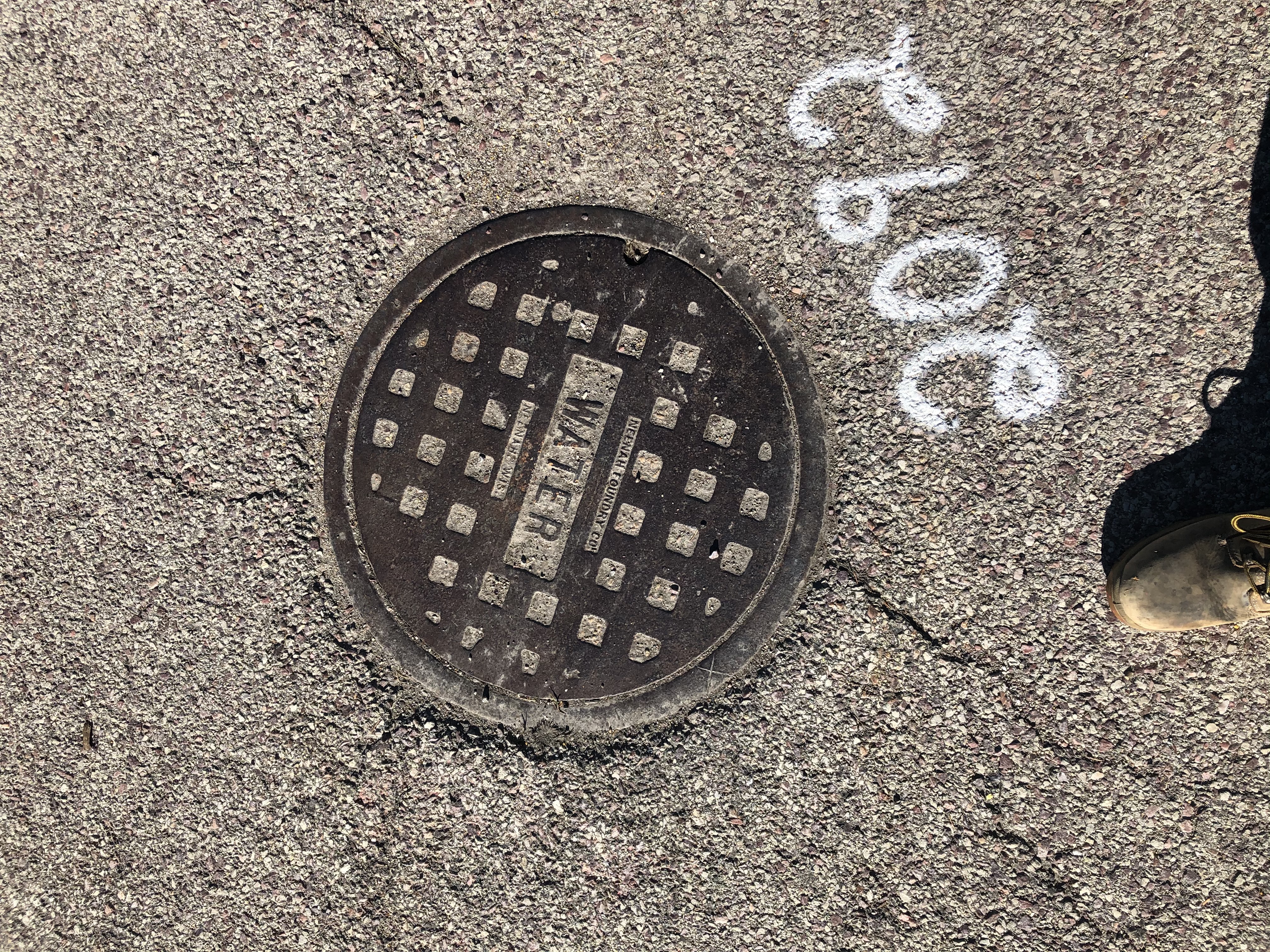
Description: Cross cut in east rim of valve vault at east side of east drive into Federal Life building, 3750 West Deerfield Road.
Elevation: 644.55 (Elevation revised on April 6, 2006 by LSM following milling & resurfacing of roadway.)
Mark confirmed on June 16, 2021 by C. Aguirre
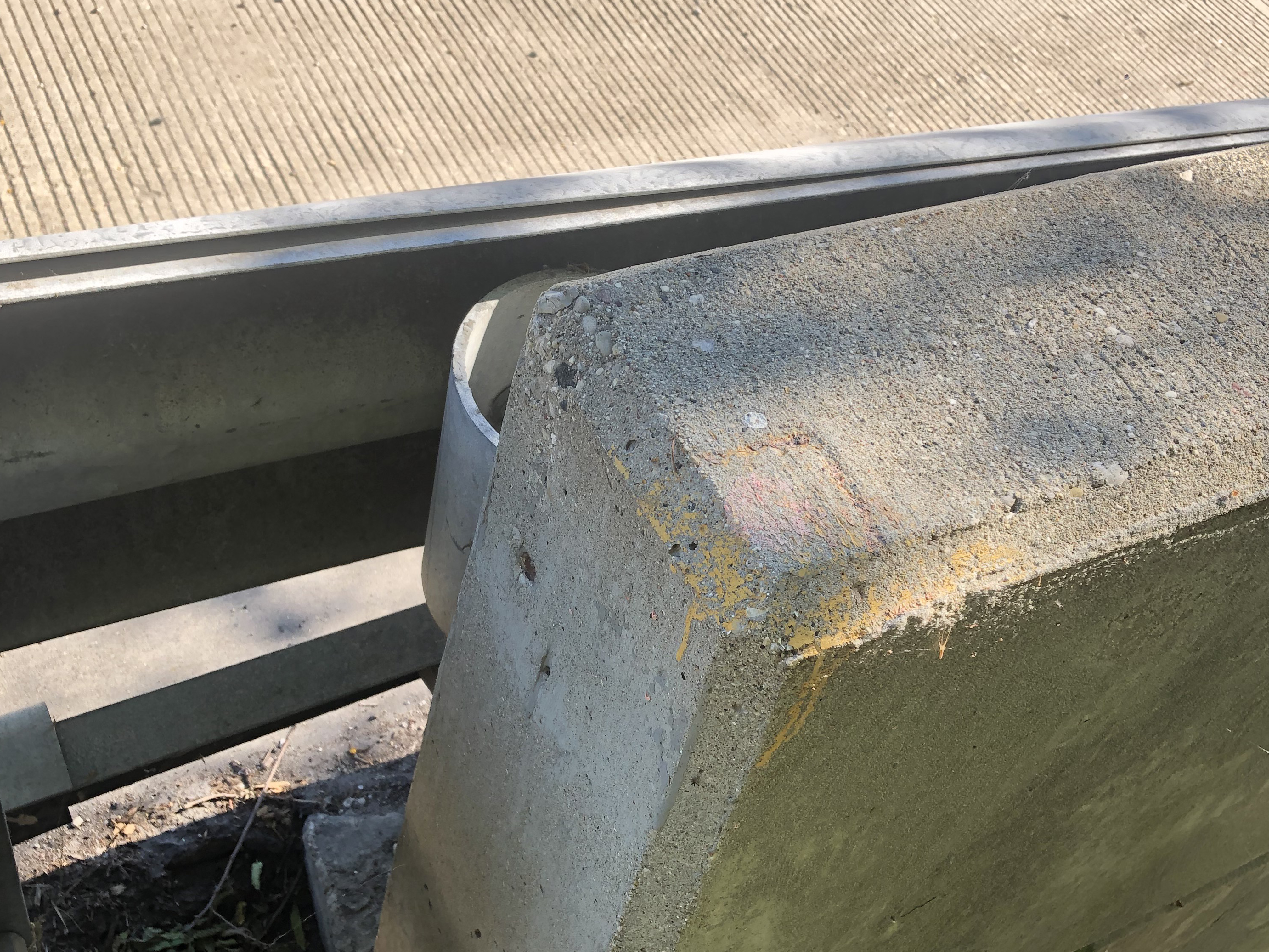
Description: Chiseled box at west end of south barrier wall on Deerfield Road Bridge over Des Plaines River.
Elevation: 649.51
Mark confirmed on June 16, 2021 by C. Aguirre
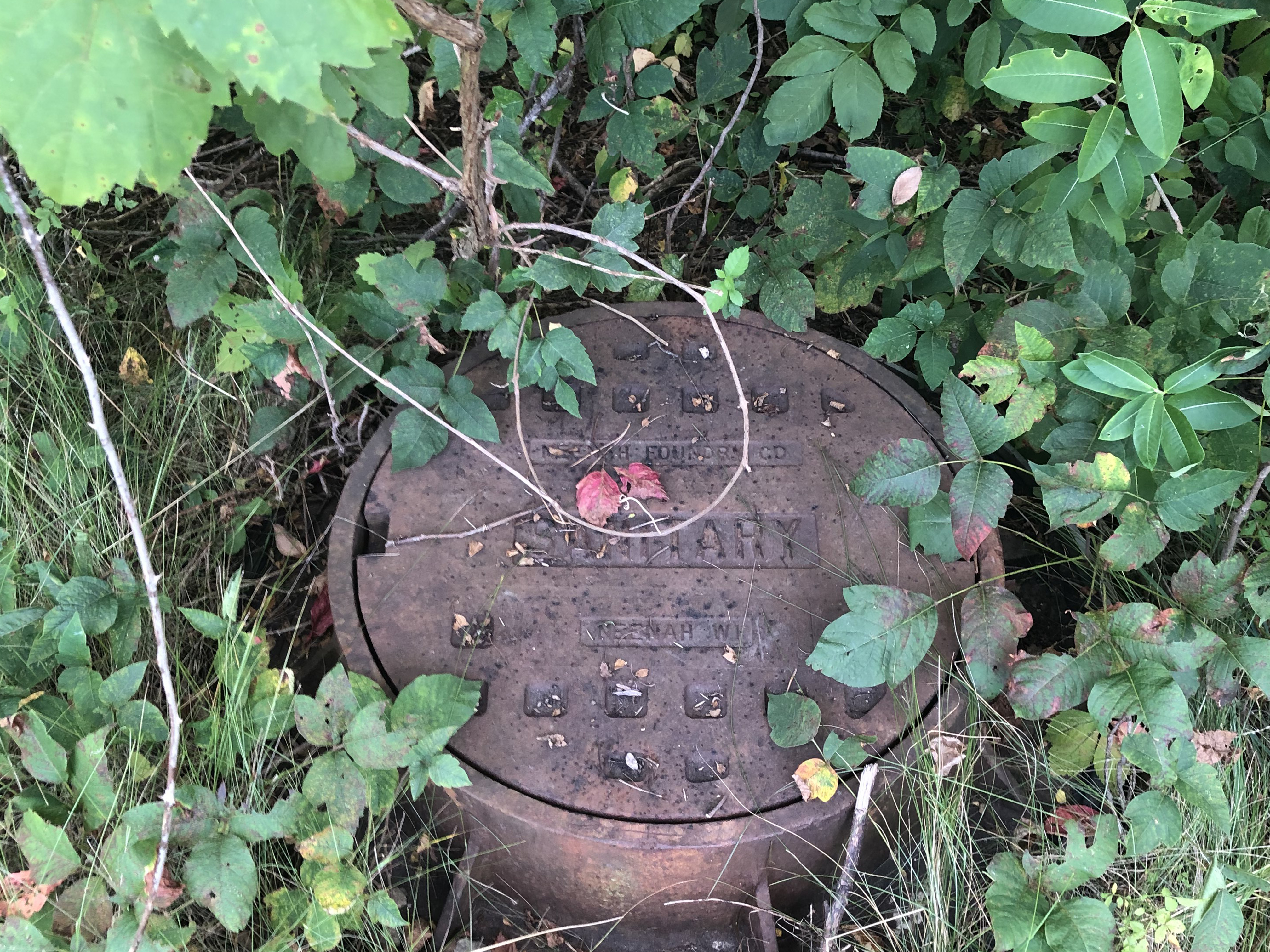
Description: Cross cut in east rim of sanitary manhole, first sanitary manhole south of Riverwoods Court on west side Riverwoods Road, directly across Riverwoods Court.
Elevation: 668.00
Mark confirmed on August 25, 2021 by C. Aguirre
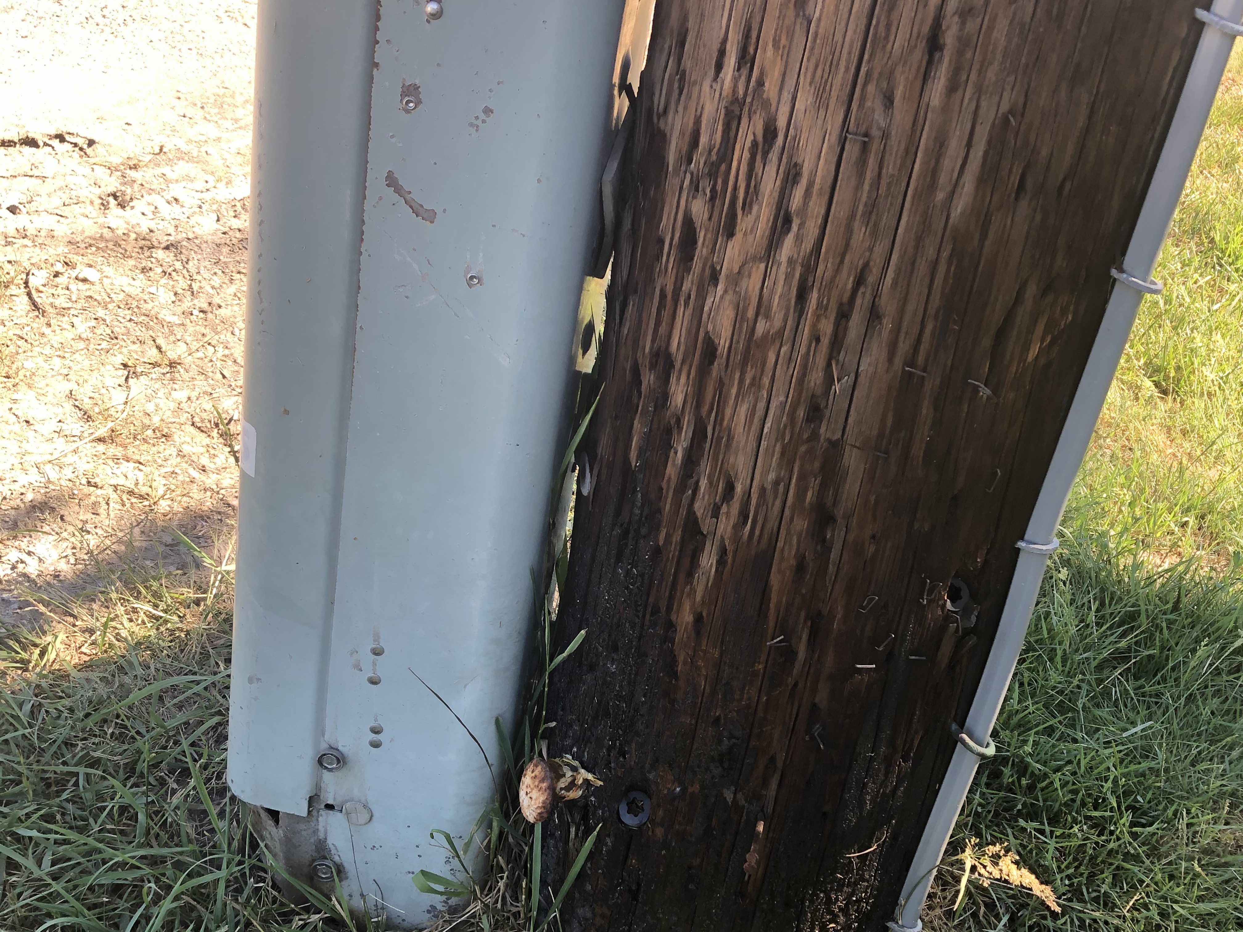
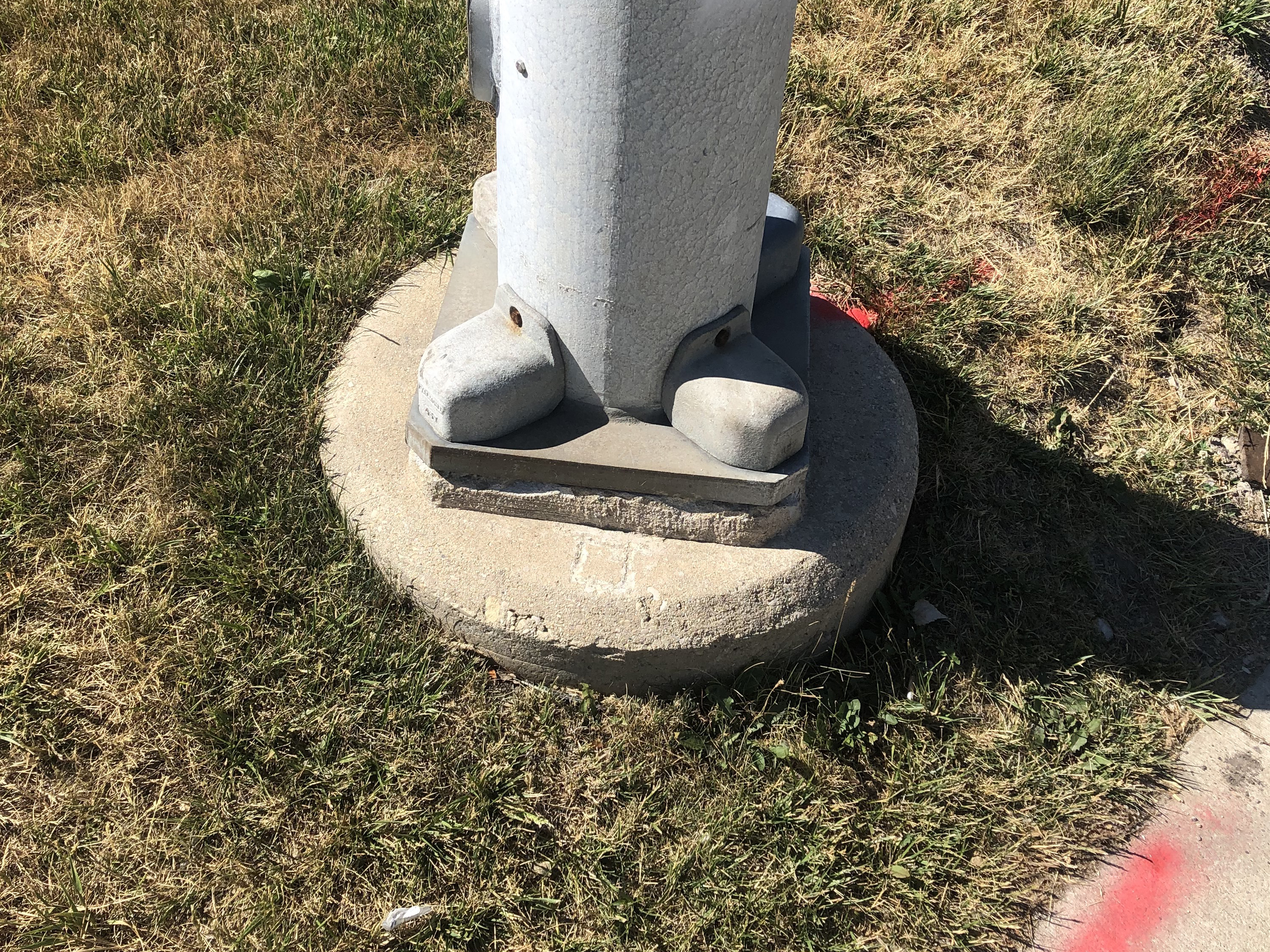
Description: Railroad spike set approximately 0.9’ above grade in west face of power pole at southeast corner of Riverwoods Road and Duffy Lane.
Elevation: 666.66
Mark confirmed on June 16, 2021 by C. Aguirre
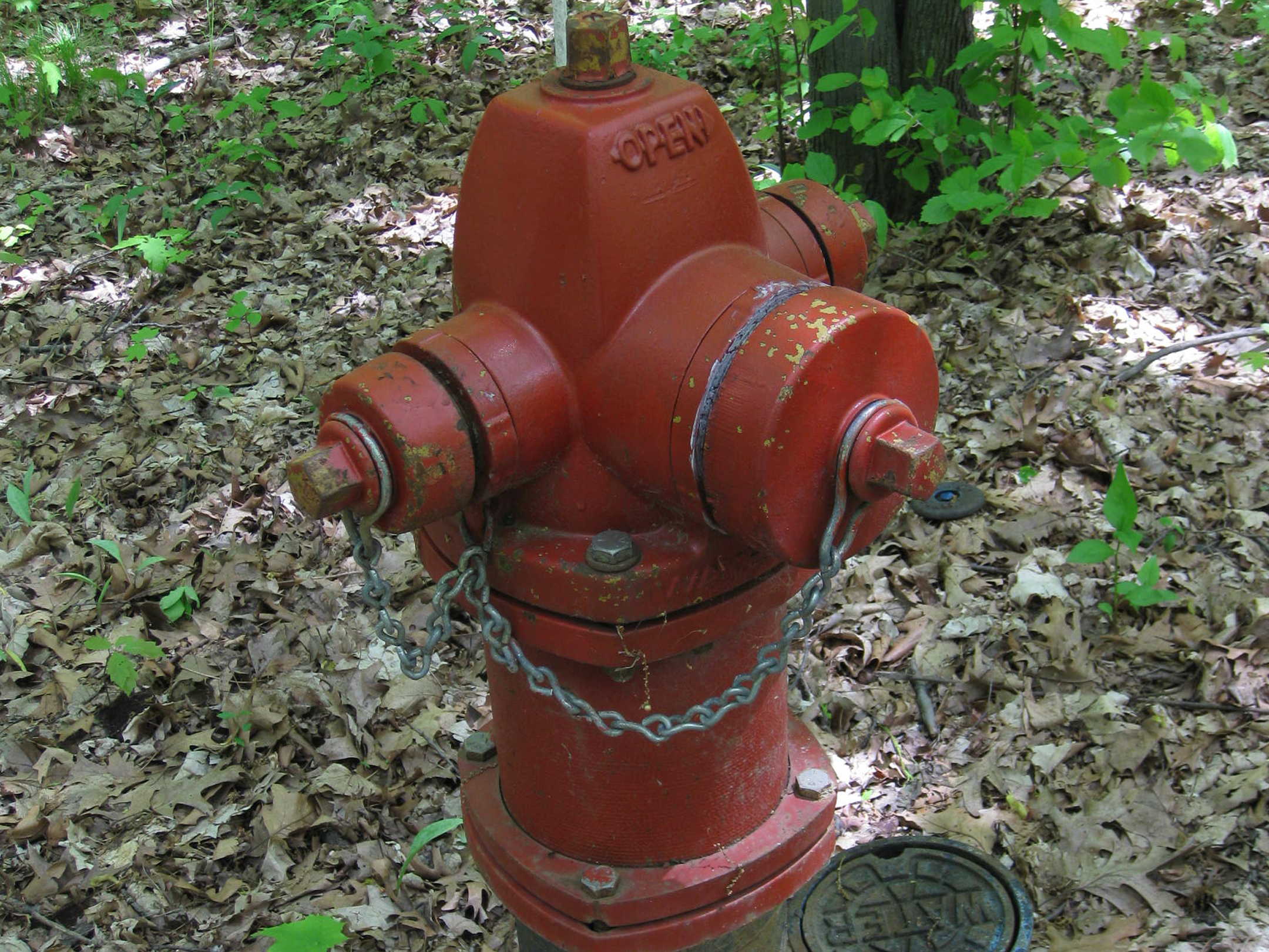
Description: NW Flange Bolt on fire hydrant adjacent to 3284 Timberwood Lane, on the east side of Timberwood Lane.
Elevation: 648.07
Mark confirmed on August 25, 2021 by C. Aguirre
Description: Chiseled square in north side concrete base of traffic signal at southeast corner of Deerfield Road and Saunders Road.
Elevation: 681.49
Mark confirmed on June 16, 2021 by C. Aguirre
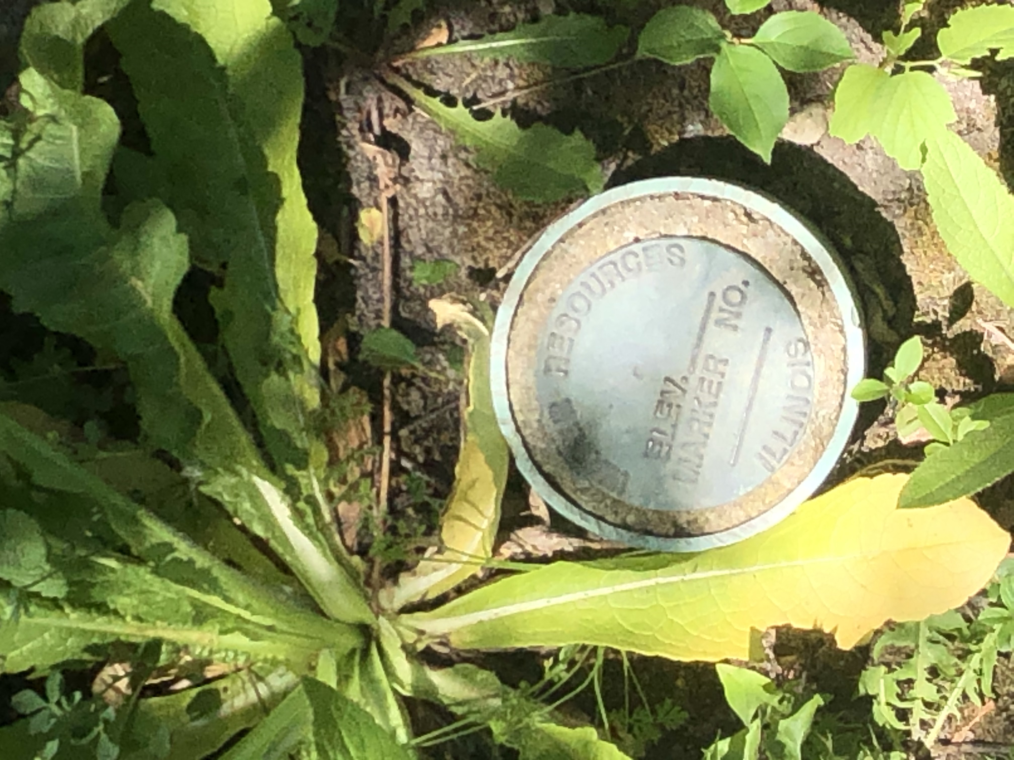
Description: Bronze survey marker on east side Saunders Road at curve to northwest north of West Course Drive. Orange survey marker post assists in the location of the bronze survey marker.
Elevation: 667.94
Mark recovered by P. Glenn on May 9, 2018. Mark confirmed on June 16, 2021 by C. Aguirre
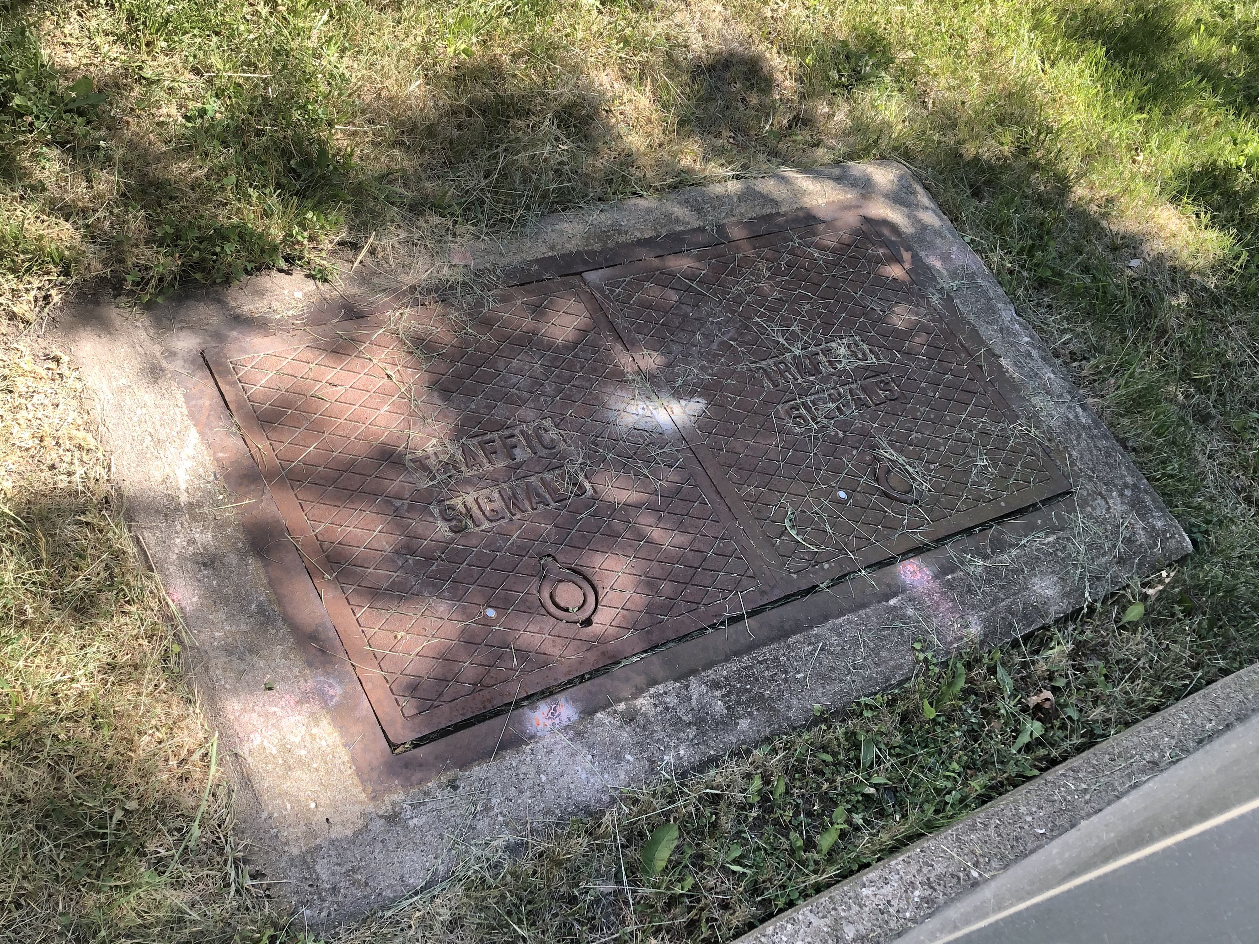
Description: Northwest corner of double traffic signal hand hole at southeast corner of Deerfield Road and Portwine Road.
Structure present, but no chiseled box or cross cut found 6/11/2019
Elevation: 655.77
Mark last confirmed on June 19, 2017 by J. Metz
Updated on June 11, 2019 by K. Hautzinger
Mark confirmed on June 16, 2021 by C. Aguirre
Benchmarks RW6, RW7, RW9, RW12 have been lost due to construction.
(MMH, March 22, 2010).